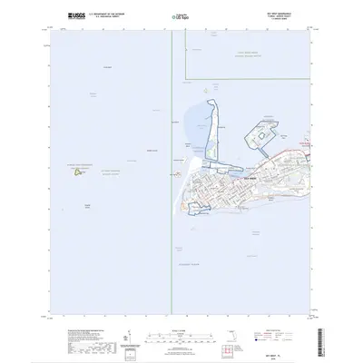
2024 Map of Key West
USGS Topo · Published 2024About this map
Key West anchors this modern topographic perspective of the lower Florida Keys, showing the dense urban grid alongside significant federal and conservation areas. The city's maritime and military identity is evident through landmarks like the Truman Annex, the Fleming Key Magazine, and the Naval Hospital. Deeply grounded in local history, the map identifies sensitive sites such as the African Slave Cem at Higgs Beach, the Key West Cem, and the Peary Court Burial Grounds.
Find a feature on this map
105 named features on this map. Tap any name to fly to it.
Don’t see what you’re looking for? This feature index may not catch every label — zoom into the map to look around manually.
Map Details
Editions of this 2024 Key West Map
This is the sole edition of this map. No revisions or reprints were ever made.
Other maps of this area

1921 · Sugar Loaf Key
USGS Topo · 1:62,500

1921 · Key West
USGS Topo · 1:62,500

1943 · Bay Keys
USGS Topo · 1:24,000

1943 · Boca Chica
USGS Topo · 1:24,000

1943 · Key West
USGS Topo · 1:24,000

1943 · Snipe Keys
USGS Topo · 1:24,000

1943 · Cottrell Key
USGS Topo · 1:24,000

1962 · Key West
USGS Topo · 1:24,000

1963 · Cottrell Key
USGS Topo · 1:24,000

1971 · Key West
USGS Topo · 1:24,000