
1921 Map of Key West
USGS Topo · Published 1921About this map
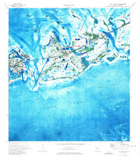
Key West and its surrounding archipelago appear here just as the island was serving as a critical naval and transportation hub. The town's dense street grid is anchored by Whitehead Pt. and protected by defensive infrastructure, including the E. Martello Tower and W. Martello Tower. This maritime landscape, compiled from earlier coastal surveys, highlights the navigation hazards and channels essential to the era's commerce, such as the Northwest Channel and the Man of War Harbor. The arrival of the East Coast Ry. is clearly visible, marking the transformative rail connection that linked the island to the Florida mainland. Stretching across Florida Bay, the map charts a series of outlying features like Cottrell Key, Woman Key, and Man Key, alongside the protective engineering of the East Jetty and West Jetty at the harbor entrance.
Find a feature on this map
37 named features on this map. Tap any name to fly to it.
Don’t see what you’re looking for? This feature index may not catch every label — zoom into the map to look around manually.
Map Details
Editions of this 1921 Key West Map
This is the sole edition of this map. No revisions or reprints were ever made.
Other maps of this area

1921 · Sugar Loaf Key
USGS Topo · 1:62,500

1943 · Bay Keys
USGS Topo · 1:24,000

1943 · Boca Chica
USGS Topo · 1:24,000

1943 · Key West
USGS Topo · 1:24,000

1943 · Snipe Keys
USGS Topo · 1:24,000

1943 · Cottrell Key
USGS Topo · 1:24,000

1962 · Key West
USGS Topo · 1:24,000

1963 · Cottrell Key
USGS Topo · 1:24,000

1971 · Key West
USGS Topo · 1:24,000
1971 · Boca Chica Key
USGS Topo · 1:24,000