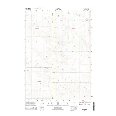
2015 Map of Keyapaha
USGS Topo · Published 2015About this map
Keyapaha and the small settlement of Linden anchor this rural landscape along the border of the Todd Co Tripp Co line. The terrain is defined by the winding course of Sand Cr, which cuts through the prairie landscape, providing a natural focal point for the surrounding homesteads and sections. Local history is preserved at the Pioneer Cem near the eastern edge of the map, a site of genealogical significance for families tied to the early ranching and farming communities of south-central South Dakota. Modern transport relies on the grid of section-line roads, including SD Hwy 53 and CR-125, which facilitate movement across this sparsely populated portion of the plains during the mid-2010s.
Find a feature on this map
24 named features on this map. Tap any name to fly to it.
Don’t see what you’re looking for? This feature index may not catch every label — zoom into the map to look around manually.
Map Details
Editions of this 2015 Keyapaha Map
This is the sole edition of this map. No revisions or reprints were ever made.
Other maps of this area

1950 · Norden
USGS Topo · 1:62,500

1950 · Sparks
USGS Topo · 1:62,500

1952 · Norden
USGS Topo · 1:62,500

1955 · Martin
USGS Topo · 1:250,000

1957 · Valentine
USGS Topo · 1:250,000

1958 · Martin
USGS Topo · 1:250,000

1959 · Valentine
USGS Topo · 1:250,000

1982 · Keyapaha SE
USGS Topo · 1:24,000
1982 · Clearfield
USGS Topo · 1:24,000

1982 · Hidden Timber SE
USGS Topo · 1:24,000