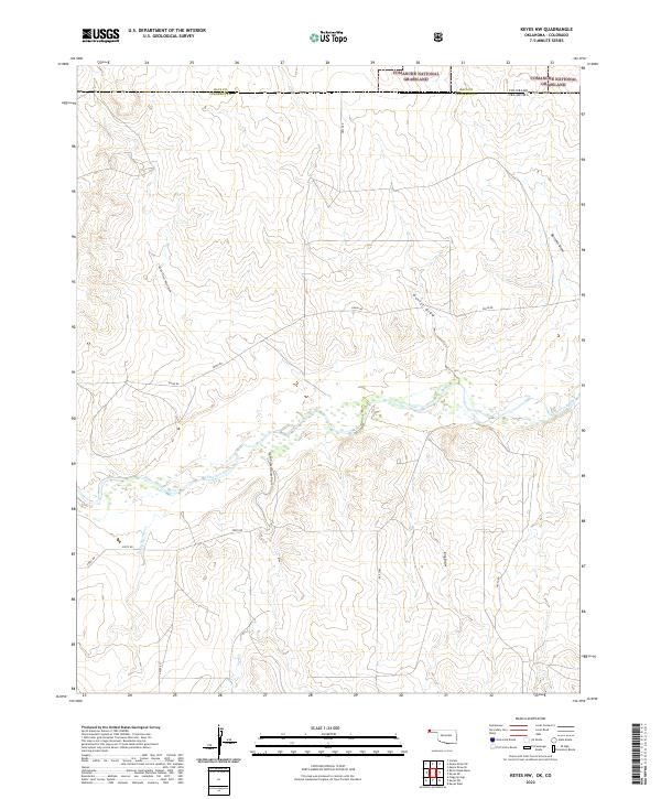
2022 Map of Keyes NW
USGS Topo · Published 2022About this map
The Cimarron River winds through the northern High Plains on this modern survey, marking a distinct topographical transition where the flat upland prairie drops into a network of canyons and drainage systems. This landscape is defined by its deep draws, including North Picket House Draw and South Picket House Draw, which channel seasonal runoff toward the river valley. The map documents the intersection of Cimarron County, Oklahoma, and Baca County, Colorado, where the Comanche National Grassland protects a portion of this arid ecosystem. A sparse but systematic grid of section roads like e0050 RD and n0300 RD provides access to ranching lands and remote water features such as Flagg Springs Cr. The presence of numerous named drainages like Nevitt Draw and King Draw highlights the vital role of water management and natural drainage in this cross-border environment.
Find a feature on this map
20 named features on this map. Tap any name to fly to it.
Don’t see what you’re looking for? This feature index may not catch every label — zoom into the map to look around manually.
Map Details
Editions of this 2022 Keyes NW Map
This is the sole edition of this map. No revisions or reprints were ever made.
Other maps of this area

1891 · Springfield
USGS Topo · 1:125,000

1892 · Vilas
USGS Topo · 1:125,000

1893 · Springfield
USGS Topo · 1:125,000

1954 · Dalhart
USGS Topo · 1:250,000

1955 · La Junta
USGS Topo · 1:250,000

1958 · La Junta
USGS Topo · 1:250,000

1958 · Dalhart
USGS Topo · 1:250,000

1962 · Dalhart
USGS Topo · 1:250,000

1968 · La Junta
USGS Topo · 1:250,000

1969 · Flagg Springs
USGS Topo · 1:24,000