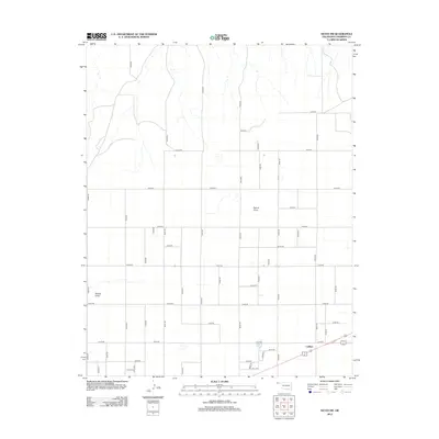
2012 Map of Keyes SW
USGS Topo · Published 2012About this map
Ludlam stands as the primary namesake settlement in this corner of Cimarron County, positioned at a crossroads where regional transport lines meet. The landscape is defined by the subtle drainage patterns of the High Plains, most notably across the ephemeral watercourses of French Draw and Adobe Draw. These natural features disrupt an otherwise rigid, rectilinear grid of county roads that carve the territory into nearly uniform agricultural and grazing blocks.
Find a feature on this map
39 named features on this map. Tap any name to fly to it.
Don’t see what you’re looking for? This feature index may not catch every label — zoom into the map to look around manually.
Map Details
Editions of this 2012 Keyes SW Map
This is the sole edition of this map. No revisions or reprints were ever made.
Other maps of this area

1954 · Dalhart
USGS Topo · 1:250,000

1958 · Dalhart
USGS Topo · 1:250,000

1962 · Dalhart
USGS Topo · 1:250,000

1969 · Boise City
USGS Topo · 1:24,000

1969 · Flagg Springs
USGS Topo · 1:24,000
1969 · Razor Blade Mesa
USGS Topo · 1:24,000

1971 · Keyes SW
USGS Topo · 1:24,000

1971 · Keyes West
USGS Topo · 1:24,000

1971 · Keyes NW
USGS Topo · 1:24,000

1971 · Keyes NE
USGS Topo · 1:24,000