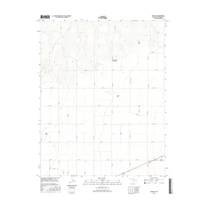
2016 Map of Keyes SW
USGS Topo · Published 2016About this map
King Draw and South Picket House Draw define the north-central topography of this Cimarron County landscape, where the high plains are carved by intermittent drainage patterns. The map reveals a strictly regulated section-line road grid, including N0300 Rd and E0110 Rd, which segments the terrain for agricultural use. In the southeast corner, the intersection of Us-64 Us-412 provides the primary transit corridor through an otherwise sparse and open territory. Other localized drainage features like French Draw and Adobe Draw illustrate the natural erosion of the plateau, while the grid of unpaved roads like N0330 Rd suggests a landscape organized for ranching and large-scale farming at the start of the 21st century.
Find a feature on this map
26 named features on this map. Tap any name to fly to it.
Don’t see what you’re looking for? This feature index may not catch every label — zoom into the map to look around manually.
Map Details
Editions of this 2016 Keyes SW Map
This is the sole edition of this map. No revisions or reprints were ever made.
Other maps of this area

1954 · Dalhart
USGS Topo · 1:250,000

1958 · Dalhart
USGS Topo · 1:250,000

1962 · Dalhart
USGS Topo · 1:250,000

1969 · Boise City
USGS Topo · 1:24,000

1969 · Flagg Springs
USGS Topo · 1:24,000
1969 · Razor Blade Mesa
USGS Topo · 1:24,000

1971 · Keyes SW
USGS Topo · 1:24,000

1971 · Keyes West
USGS Topo · 1:24,000

1971 · Keyes NW
USGS Topo · 1:24,000

1971 · Keyes NE
USGS Topo · 1:24,000