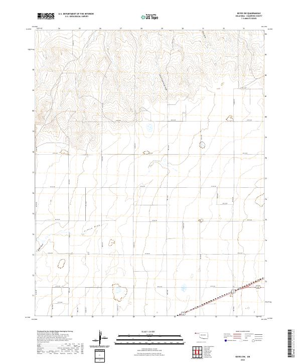
2022 Map of Keyes SW
USGS Topo · Published 2022About this map
French Draw and South Picket House Draw snake through this section of the Oklahoma Panhandle, illustrating the drainage patterns that define the high plains of Cimarron County. The landscape is primarily organized by a rigid section-line road grid, including N0300 Rd and E0120 Rd, which reflects the enduring Public Land Survey System layout. This grid-based development underscores the region's agricultural and ranching foundation, where wide-open spaces are punctuated by occasional natural depressions and seasonal watercourses. The presence of King Draw in the north and Adobe Draw in the southwest shows how these intermittent streams provide the only significant breaks in the flat topography. This survey captures a rural landscape where the placement of section-line roads dictates the movement and settlement patterns of this arid prairie environment.
Find a feature on this map
31 named features on this map. Tap any name to fly to it.
Don’t see what you’re looking for? This feature index may not catch every label — zoom into the map to look around manually.
Map Details
Editions of this 2022 Keyes SW Map
This is the sole edition of this map. No revisions or reprints were ever made.
Other maps of this area

1954 · Dalhart
USGS Topo · 1:250,000

1958 · Dalhart
USGS Topo · 1:250,000

1962 · Dalhart
USGS Topo · 1:250,000

1969 · Boise City
USGS Topo · 1:24,000

1969 · Flagg Springs
USGS Topo · 1:24,000
1969 · Razor Blade Mesa
USGS Topo · 1:24,000

1971 · Keyes SW
USGS Topo · 1:24,000

1971 · Keyes West
USGS Topo · 1:24,000

1971 · Keyes NW
USGS Topo · 1:24,000

1971 · Keyes NE
USGS Topo · 1:24,000