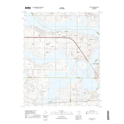
2018 Map of Keystone Dam
USGS Topo · Published 2018About this map
Keystone Lake dominates this 2018 topographic landscape, where the convergence of the Arkansas and Cimarron rivers is managed by the Keystone Dam. The map reveals a complex interface between water and land, showing how the reservoir’s fingers reach into several counties, including Pawnee, Osage, Creek, and Tulsa. The shoreline is dotted with small residential clusters and named points such as Mule Barn, Sha-To-She, and Baugh, reflecting modern recreational and residential development near the water.
Find a feature on this map
121 named features on this map. Tap any name to fly to it.
Don’t see what you’re looking for? This feature index may not catch every label — zoom into the map to look around manually.
Map Details
Editions of this 2018 Keystone Dam Map
This is the sole edition of this map. No revisions or reprints were ever made.
Other maps of this area

1912 · Hominy
USGS Topo · 1:125,000

1915 · Hominy
USGS Topo · 1:125,000

1915 · Hominy
USGS Topo · 1:62,500

1955 · Enid
USGS Topo · 1:250,000

1958 · Enid
USGS Topo · 1:250,000

1958 · Keystone Dam
USGS Topo · 1:24,000
1958 · Mannford SE
USGS Topo · 1:24,000

1958 · Wekiwa
USGS Topo · 1:24,000
1959 · Lake Sahoma
USGS Topo · 1:24,000

1966 · Cleveland
USGS Topo · 1:24,000