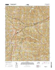
2016 Map of Keysville
USGS Topo · Published 2016About this map
Keysville serves as the primary hub of this Southside Virginia landscape, where the intersections of historic transport routes and local education define the community's modern layout. The Southside Virginia Community College - John H Daniel Campus stands as a prominent fixture just east of the town center, representing the area's role in regional education. The geography is characterized by a dense network of tributaries including the North Meherrin River, Gills Creek, and Turkey Egg Creek, which carve through the undulating terrain of Charlotte and Prince Edward counties.
Find a feature on this map
97 named features on this map. Tap any name to fly to it.
Don’t see what you’re looking for? This feature index may not catch every label — zoom into the map to look around manually.
Map Details
Editions of this 2016 Keysville Map
This is the sole edition of this map. No revisions or reprints were ever made.
Other maps of this area

1891 · Farmville
USGS Topo · 1:125,000

1892 · Appomattox
USGS Topo · 1:125,000

1893 · Farmville
USGS Topo · 1:125,000

1947 · Roanoke
USGS Topo · 1:250,000

1953 · Greensboro
USGS Topo · 1:250,000

1954 · Greensboro
USGS Topo · 1:250,000

1954 · Clover
USGS Topo · 1:62,500

1955 · Chase City
USGS Topo · 1:62,500

1956 · Charlotte Court House
USGS Topo · 1:62,500

1958 · Keysville
USGS Topo · 1:62,500