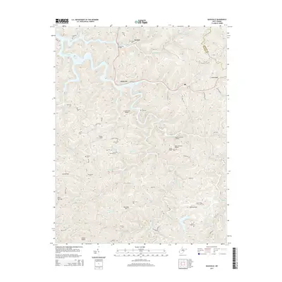
2014 Map of Kiahsville
USGS Topo · Published 2014About this map
E Lynn Lake anchors the northwest corner of this West Virginia landscape, where the waters of Lick Creek and its many branches carve through a complex network of ridges. The map illustrates a deeply rooted community structure defined by family-named hollows and cemeteries, including Adkins Cem, Maynard Cem, and Pat Maynard Cem. Settlements like Kiahsville and Brabant are connected by winding routes like WV 37, following the natural contours of the terrain near Crackersneck Ridge and McComas Mountain. This 2014 survey reveals how the local geography still dictates the placement of infrastructure, with Twelvepole Creek and East Fork Twelvepole Creek serving as primary drainage corridors for the region. The map provides a detailed view for genealogists tracking local families near Queens Ridge or researchers studying the transition from historical coal haul roads to the modern secondary road system.
Find a feature on this map
108 named features on this map. Tap any name to fly to it.
Don’t see what you’re looking for? This feature index may not catch every label — zoom into the map to look around manually.
Map Details
Editions of this 2014 Kiahsville Map
This is the sole edition of this map. No revisions or reprints were ever made.
Other maps of this area

1887 · Warfield
USGS Topo · 1:125,000

1891 · Warfield
USGS Topo · 1:125,000

1892 · Huntington
USGS Topo · 1:125,000

1898 · Huntington
USGS Topo · 1:125,000

1902 · Midkiff
USGS Topo · 1:62,500

1907 · Midkiff
USGS Topo · 1:62,500

1909 · Wayne
USGS Topo · 1:62,500

1909 · Midkiff
USGS Topo · 1:62,500

1910 · Holden
USGS Topo · 1:48,000

1910 · Naugatuck
USGS Topo · 1:48,000