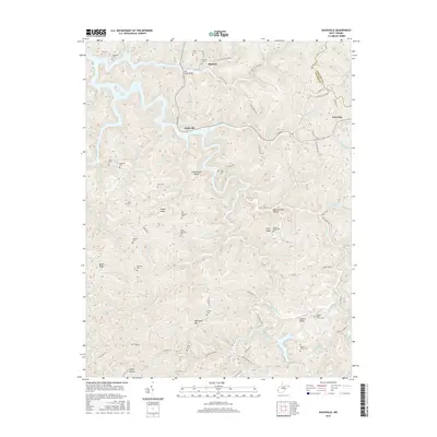
2016 Map of Kiahsville
USGS Topo · Published 2016About this map
Kiahsville and Brabant anchor this survey of the rugged Wayne and Lincoln County borderlands, where narrow hollows and high ridges dictate the local geography. The landscape is heavily marked by familial history, preserved in numerous small burial grounds such as the Smith Cem, Maynard Cem, and Pat Maynard Cem that dot the hillsides. The winding course of Kiah Cr and the Left Fork Lick Creek serve as primary corridors for development, with roads like E Lynn Rd following the water. Distinctive landmarks like McComas Mtn and Crackersneck Ridge rise above the drainage basins of Big Laurel Cr and Queens Fork. Modern industrial activity is evidenced by the Coal Haul Rd and Strip Mine Rd in the southern reaches of the quadrangle, reflecting the region's long-standing connection to resource extraction.
Find a feature on this map
112 named features on this map. Tap any name to fly to it.
Don’t see what you’re looking for? This feature index may not catch every label — zoom into the map to look around manually.
Map Details
Editions of this 2016 Kiahsville Map
This is the sole edition of this map. No revisions or reprints were ever made.
Other maps of this area

1887 · Warfield
USGS Topo · 1:125,000

1891 · Warfield
USGS Topo · 1:125,000

1892 · Huntington
USGS Topo · 1:125,000

1898 · Huntington
USGS Topo · 1:125,000

1902 · Midkiff
USGS Topo · 1:62,500

1907 · Midkiff
USGS Topo · 1:62,500

1909 · Wayne
USGS Topo · 1:62,500

1909 · Midkiff
USGS Topo · 1:62,500

1910 · Holden
USGS Topo · 1:48,000

1910 · Naugatuck
USGS Topo · 1:48,000