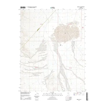
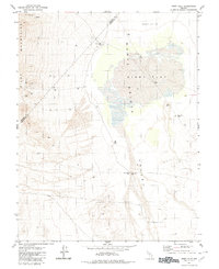
2014 Map of Kibby Flat
USGS Topo · Published 2014About this map
Kibby Flat dominates this high-desert landscape in central Nevada, appearing as a prominent alkali or dry lake bed feature. Situated within the larger Monte Cristo Valley, the topography is defined by broad alluvial fans that descend from the surrounding ranges toward the flat's floor. A critical water source in this arid environment, Salt Marsh Spring is located along the western margin of the valley floor. The map also delineates the boundary between Mineral County and Esmeralda County, which cuts diagonally across the northern portion of the quadrangle. This 2014 survey documents a largely undeveloped corridor where the primary land use remains public land management, marked by the extensive Public Land Survey System grid that organizes this vast interior basin.
Find a feature on this map
9 named features on this map. Tap any name to fly to it.
Don’t see what you’re looking for? This feature index may not catch every label — zoom into the map to look around manually.
Map Details
Editions of this 2014 Kibby Flat Map
This is the sole edition of this map. No revisions or reprints were ever made.
Other maps of this area

1907 · Tonopah
USGS Topo · 1:250,000

1908 · Tonopah
USGS Topo · 1:250,000

1956 · Tonopah
USGS Topo · 1:250,000

1959 · Tonopah
USGS Topo · 1:250,000

1962 · Tonopah
USGS Topo · 1:250,000
1968 · Coaldale NE
USGS Topo · 1:24,000
1968 · Rock Hill
USGS Topo · 1:24,000
1968 · Gilbert
USGS Topo · 1:24,000
1980 · Kibby Flat
USGS Topo · 1:24,000

1980 · Cole Spring
USGS Topo · 1:24,000