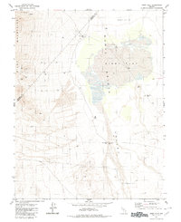
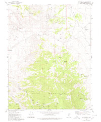
1980 Map of Kibby Flat
USGS Topo · Published 1980About this map
Pilot Mountains dominate the western edge of this Nevada landscape, where the high terrain transitions into the broad, arid expanse of the Monte Cristo Valley. This region is defined by its industrial history, particularly the mining activity concentrated in the uplands. Near the summit areas, researchers can locate the Tiffany Mine alongside several other unnamed Mines and a Mine site, while the eastern flats reveal the industrial footprint of the Dunham Mill (Site). The valley floor is punctuated by various water and infrastructure points, including the Kibby Flat Well and a Micro Wave Well, reflecting the remote logistics of the Great Basin. Large geological features like Kibby Flat and several surrounding basins marked Depression characterize the local drainage patterns and terminal basins common to this part of Esmeralda County and Mineral County.
Find a feature on this map
15 named features on this map. Tap any name to fly to it.
Don’t see what you’re looking for? This feature index may not catch every label — zoom into the map to look around manually.
Map Details
Editions of this 1980 Kibby Flat Map
This is the sole edition of this map. No revisions or reprints were ever made.
Other maps of this area

1907 · Tonopah
USGS Topo · 1:250,000

1908 · Tonopah
USGS Topo · 1:250,000

1956 · Tonopah
USGS Topo · 1:250,000

1959 · Tonopah
USGS Topo · 1:250,000

1962 · Tonopah
USGS Topo · 1:250,000
1968 · Coaldale NE
USGS Topo · 1:24,000
1968 · Rock Hill
USGS Topo · 1:24,000
1968 · Gilbert
USGS Topo · 1:24,000

1980 · Cole Spring
USGS Topo · 1:24,000
1980 · Bettles Well
USGS Topo · 1:24,000