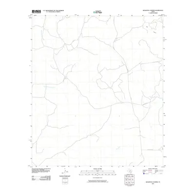
2010 Map of Kickapoo Caverns
USGS Topo · Published 2010About this map
Pinto Creek and Griffin Creek flow through this section of Kinney County, tracing a landscape defined by deep drainage networks and isolated ranching access. This 2010 survey reflects a sparsely populated region of Texas where infrastructure is primarily represented by long-reaching corridors like RM 674 and private thoroughfares such as Leona Ranch Rd. The topography is dominated by dramatic natural features including the prominent Big Canyon in the northeast and the winding path of East Fork Sycamore Creek. Modern road data from the U.S. Census Bureau TIGER files outlines the limited terrestrial connectivity, showing how Cedar Creek Rd and other local routes navigate the terrain between seasonal watercourses and expansive ranch properties.
Find a feature on this map
7 named features on this map. Tap any name to fly to it.
Don’t see what you’re looking for? This feature index may not catch every label — zoom into the map to look around manually.
Map Details
Editions of this 2010 Kickapoo Caverns Map
This is the sole edition of this map. No revisions or reprints were ever made.
Other maps of this area

1893 · Nueces
USGS Topo · 1:125,000

1896 · Nueces
USGS Topo · 1:125,000

1896 · Brackett
USGS Topo · 1:125,000

1897 · Brackett
USGS Topo · 1:125,000

1941 · Standart
USGS Topo · 1:62,500

1943 · Standart
USGS Topo · 1:62,500

1944 · Flat Rock
USGS Topo · 1:62,500

1944 · Brackettville
USGS Topo · 1:62,500

1944 · Indian Mountain
USGS Topo · 1:62,500

1958 · Del Rio
USGS Topo · 1:250,000