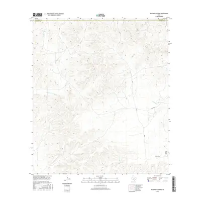
2016 Map of Kickapoo Caverns
USGS Topo · Published 2016About this map
Big Canyon dominates the northern landscape of this Texas ranching region, where the high Edwards Plateau begins its descent toward the Rio Grande basin. The 2016 survey documents a sparse, upland terrain defined by ephemeral drainage networks including Pinto Cr, Griffin Cr, and the E Fork Sycamore Cr. This area on the border of Kinney and Edwards Counties is characterized by large-scale landholdings and limited infrastructure, centered around RM 674. Notable private aviation access is marked at the Leona Ranch Airport in the southeast, accessed via Leona Ranch Rd. The map illustrates the specialized transportation needs of isolated ranching operations, where modern unpaved routes like Cedar Creek Rd provide the primary connectivity across the deep dissected canyons.
Find a feature on this map
9 named features on this map. Tap any name to fly to it.
Don’t see what you’re looking for? This feature index may not catch every label — zoom into the map to look around manually.
Map Details
Editions of this 2016 Kickapoo Caverns Map
This is the sole edition of this map. No revisions or reprints were ever made.
Other maps of this area

1893 · Nueces
USGS Topo · 1:125,000

1896 · Nueces
USGS Topo · 1:125,000

1896 · Brackett
USGS Topo · 1:125,000

1897 · Brackett
USGS Topo · 1:125,000

1941 · Standart
USGS Topo · 1:62,500

1943 · Standart
USGS Topo · 1:62,500

1944 · Flat Rock
USGS Topo · 1:62,500

1944 · Brackettville
USGS Topo · 1:62,500

1944 · Indian Mountain
USGS Topo · 1:62,500

1958 · Del Rio
USGS Topo · 1:250,000