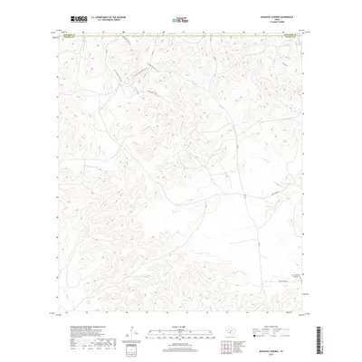
2019 Map of Kickapoo Caverns
USGS Topo · Published 2019About this map
Barbado Ridge Trail and the Seargeant Memorial Trail traverse the ridgelines of this Southwest Texas landscape, marking a modern era of recreational access within the limestone hills of the Edwards Plateau. The map reveals a land defined by its drainage systems, including the E Fork Sycamore Cr and Griffin Cr, which carve through the terrain near the boundary between Edwards and Kinney counties. While much of the area remains dominated by large ranching tracts, the presence of the Leona Ranch Airport along Leona Ranch Rd indicates the logistical infrastructure required for managing such expansive properties. Scenic outlooks like Vireo Vista and winding paths such as The Long Way Home Trail and the Pine Canyon Loop suggest a transition toward conservation and ecological tourism in this karst-heavy region.
Find a feature on this map
14 named features on this map. Tap any name to fly to it.
Don’t see what you’re looking for? This feature index may not catch every label — zoom into the map to look around manually.
Map Details
Editions of this 2019 Kickapoo Caverns Map
This is the sole edition of this map. No revisions or reprints were ever made.
Other maps of this area

1893 · Nueces
USGS Topo · 1:125,000

1896 · Nueces
USGS Topo · 1:125,000

1896 · Brackett
USGS Topo · 1:125,000

1897 · Brackett
USGS Topo · 1:125,000

1941 · Standart
USGS Topo · 1:62,500

1943 · Standart
USGS Topo · 1:62,500

1944 · Flat Rock
USGS Topo · 1:62,500

1944 · Brackettville
USGS Topo · 1:62,500

1944 · Indian Mountain
USGS Topo · 1:62,500

1958 · Del Rio
USGS Topo · 1:250,000