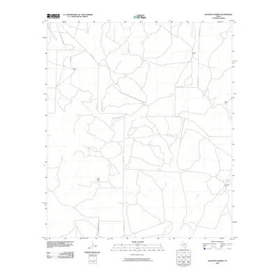
2010 Map of Kickapoo Spring
USGS Topo · Published 2010About this map
Kickapoo Spring and the surrounding drainage of Kickapoo Creek define this landscape in Tom Green County, reflecting a region where water sources dictate the placement of early homesteads and ranching operations. The map documents a sparsely populated area characterized by large family holdings such as the Joe Mertz Ranch, Barron Ranch, and the Denis Ranch. These established properties are connected by a network of rural routes including Susan Peak Rd and Fort McKavett Rd, the latter indicating the historical path toward the 19th-century military outpost. Intermittent waterways like Hog Marsh Creek and Lipan Creek carve through the terrain, illustrating the hydrologic patterns essential for sustaining livestock in West Texas. For the local historian or genealogist, the naming of specific properties like the James Barron Ranch and Mathews Ranch provides a clear record of land ownership and residency during this period.
Find a feature on this map
14 named features on this map. Tap any name to fly to it.
Don’t see what you’re looking for? This feature index may not catch every label — zoom into the map to look around manually.
Map Details
Editions of this 2010 Kickapoo Spring Map
This is the sole edition of this map. No revisions or reprints were ever made.
Other maps of this area

1892 · San Angelo
USGS Topo · 1:125,000

1928 · Wall
USGS Topo · 1:62,500

1954 · San Angelo
USGS Topo · 1:250,000

1957 · Eola
USGS Topo · 1:62,500

1957 · Wall
USGS Topo · 1:62,500

1958 · San Angelo
USGS Topo · 1:250,000

1965 · San Angelo
USGS Topo · 1:250,000

1970 · Rocking Chair Ranch
USGS Topo · 1:24,000
1970 · Burr Oak Creek
USGS Topo · 1:24,000
1970 · Del Venado Ranch
USGS Topo · 1:24,000