
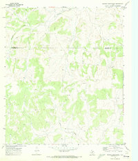
1970 Map of Rocking Chair Ranch
USGS Topo · Published 1973About this map
Kickapoo Creek and Rocky Creek carve through the plateau of the Edwards Plateau region, defining a landscape dominated by large-scale ranching and emerging mineral extraction. The boundary between Tom Green Co and Schleicher Co bisects the northern half of this area, where the eponymous Rocking Chair Ranch and Crowbar Ranch serve as primary landmarks in a sparsely populated territory. The presence of several Drill Holes, a Gas Well, and an Oil Well suggests the expansion of the Permian Basin's energy footprint into these traditional grazing lands during the late 1960s. This survey, based on 1968 aerial photography, uses fine dashed lines to indicate property fence lines, providing a precise record of land division and range management at a time when the region's economy was increasingly balanced between livestock and petroleum.
Find a feature on this map
9 named features on this map. Tap any name to fly to it.
Don’t see what you’re looking for? This feature index may not catch every label — zoom into the map to look around manually.
Map Details
Editions of this 1970 Rocking Chair Ranch Map
2 editions found
Other maps of this area

1892 · San Angelo
USGS Topo · 1:125,000

1893 · Fort McKavett
USGS Topo · 1:125,000

1954 · Sonora
USGS Topo · 1:250,000

1954 · San Angelo
USGS Topo · 1:250,000

1958 · Sonora
USGS Topo · 1:250,000

1958 · San Angelo
USGS Topo · 1:250,000

1963 · Adams
USGS Topo · 1:24,000

1965 · San Angelo
USGS Topo · 1:250,000
1970 · Burr Oak Creek
USGS Topo · 1:24,000
1970 · Del Venado Ranch
USGS Topo · 1:24,000