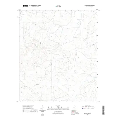
2019 Map of Kickapoo Spring
USGS Topo · Published 2019About this map
Kickapoo Spring and Rust Spring define the hydrological character of this Tom Green County landscape, where seasonal drainages carve through the Edwards Plateau terrain. The map reveals a ranching economy structured by long-established transit corridors, including the winding Fort McKavett Rd and the family-named Jim Barron Rd. Unlike more developed regions, this area maintains its rural layout with significant landholdings accessed via routes like Bill Pfluger Road Private. The drainage patterns of Kickapoo Cr and Hog Marsh Cr dictate the placement of local infrastructure, while names like Schoolhouse Rd and Rocking Chair Rd provide clues to the community’s historical landmarks and grazing heritage.
Find a feature on this map
15 named features on this map. Tap any name to fly to it.
Don’t see what you’re looking for? This feature index may not catch every label — zoom into the map to look around manually.
Map Details
Editions of this 2019 Kickapoo Spring Map
This is the sole edition of this map. No revisions or reprints were ever made.
Other maps of this area

1892 · San Angelo
USGS Topo · 1:125,000

1928 · Wall
USGS Topo · 1:62,500

1954 · San Angelo
USGS Topo · 1:250,000

1957 · Eola
USGS Topo · 1:62,500

1957 · Wall
USGS Topo · 1:62,500

1958 · San Angelo
USGS Topo · 1:250,000

1965 · San Angelo
USGS Topo · 1:250,000

1970 · Rocking Chair Ranch
USGS Topo · 1:24,000
1970 · Burr Oak Creek
USGS Topo · 1:24,000
1970 · Del Venado Ranch
USGS Topo · 1:24,000