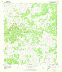
1970 Map of Kickapoo Spring
USGS Topo · Published 1973About this map
The rolling ranchlands of Tom Green County are defined here by a network of drainage systems and family-held livestock operations. Several prominent estates, including the James Barron Ranch and the Joe Mertz Ranch, are situated among the winding courses of Kickapoo Creek and Hog Marsh Creek. These seasonal water sources, punctuated by numerous man-made Tank reservoirs, reflect the essential infrastructure required for cattle ranching in this arid Texas environment.
Find a feature on this map
14 named features on this map. Tap any name to fly to it.
Don’t see what you’re looking for? This feature index may not catch every label — zoom into the map to look around manually.
Map Details
Editions of this 1970 Kickapoo Spring Map
This is the sole edition of this map. No revisions or reprints were ever made.
Other maps of this area

1892 · San Angelo
USGS Topo · 1:125,000

1928 · Wall
USGS Topo · 1:62,500

1954 · San Angelo
USGS Topo · 1:250,000

1957 · Eola
USGS Topo · 1:62,500

1957 · Wall
USGS Topo · 1:62,500

1958 · San Angelo
USGS Topo · 1:250,000

1965 · San Angelo
USGS Topo · 1:250,000

1970 · Rocking Chair Ranch
USGS Topo · 1:24,000
1970 · Burr Oak Creek
USGS Topo · 1:24,000
1970 · Del Venado Ranch
USGS Topo · 1:24,000