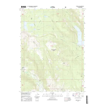
2017 Map of Kidney Lake
USGS Topo · Published 2017About this map
Ashley National Forest dominates this high-altitude landscape in the High Uintas, where a complex network of glacial lakes and rugged drainage basins defines the terrain. The eastern edge is anchored by the significant waters of Moon Lake, while the western high country features the namesake Kidney Lake, Island Lake, and the expansive Brown Duck Basin. This era of the forest's management is characterized by established recreational and pack infrastructure, notably around Miners Gulch in the southwest, where the Miners Gulch Campground and Miners Gulch Bridge provide access near the Rock Creek drainage.
Find a feature on this map
50 named features on this map. Tap any name to fly to it.
Don’t see what you’re looking for? This feature index may not catch every label — zoom into the map to look around manually.
Map Details
Editions of this 2017 Kidney Lake Map
This is the sole edition of this map. No revisions or reprints were ever made.
Other maps of this area

1885 · Uinta
USGS Topo · 1:250,000

1901 · Hayden Peak
USGS Topo · 1:125,000

1903 · Hayden Peak
USGS Topo · 1:125,000

1905 · Gilbert Peak
USGS Topo · 1:125,000

1906 · Gilbert Peak
USGS Topo · 1:125,000

1939 · Duchesne
USGS Topo · 1:125,000

1954 · Salt Lake City
USGS Topo · 1:250,000

1958 · Salt Lake City
USGS Topo · 1:250,000

1960 · Salt Lake City
USGS Topo · 1:250,000

1962 · Dry Mountain
USGS Topo · 1:24,000