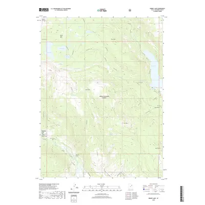
2020 Map of Kidney Lake
USGS Topo · Published 2020About this map
Ashley National Forest dominates this high-altitude landscape in the Uinta Mountains, where a complex network of alpine basins and drainages forms the headwaters of the Lake Fork River. The geography is defined by a dense concentration of glacial lakes, including Kidney Lake, Island Lake, and the larger Moon Lake in the east. This era of land management emphasizes recreational access and hydrological monitoring, evidenced by the infrastructure at Miners Gulch and the inclusion of numerous named springs such as Red Bedground Spring and Cold Spring. Connectivity across the ridgelines is maintained through primitive routes like the Atwine Cutoff and Tworoose Pass, which link the Brown Duck Basin with adjacent canyons. These features illustrate the area's dual role as both a protected wilderness and a critical water source for the region.
Find a feature on this map
38 named features on this map. Tap any name to fly to it.
Don’t see what you’re looking for? This feature index may not catch every label — zoom into the map to look around manually.
Map Details
Editions of this 2020 Kidney Lake Map
This is the sole edition of this map. No revisions or reprints were ever made.
Other maps of this area

1885 · Uinta
USGS Topo · 1:250,000

1901 · Hayden Peak
USGS Topo · 1:125,000

1903 · Hayden Peak
USGS Topo · 1:125,000

1905 · Gilbert Peak
USGS Topo · 1:125,000

1906 · Gilbert Peak
USGS Topo · 1:125,000

1939 · Duchesne
USGS Topo · 1:125,000

1954 · Salt Lake City
USGS Topo · 1:250,000

1958 · Salt Lake City
USGS Topo · 1:250,000

1960 · Salt Lake City
USGS Topo · 1:250,000

1962 · Dry Mountain
USGS Topo · 1:24,000