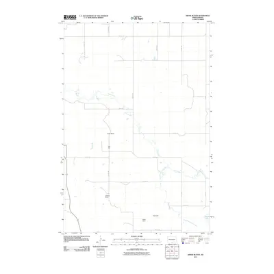
2011 Map of Kiefer Buttes
USGS Topo · Published 2011About this map
Kiefer Buttes and Hall Hill rise from the landscape of western Emmons County, defining a region where the vast plains are punctuated by significant topographic landmarks. This North Dakota prairie is etched by the winding course of Cattail Creek and its tributary, South Branch Cattail Creek, which drain toward the Missouri River valley just to the west. To the south, prominent rises like Lookout Butte, Smith Butte, and Fritz Butte provided early travelers and residents with essential vantage points for navigation and survey across the open range.
Find a feature on this map
23 named features on this map. Tap any name to fly to it.
Don’t see what you’re looking for? This feature index may not catch every label — zoom into the map to look around manually.
Map Details
Editions of this 2011 Kiefer Buttes Map
This is the sole edition of this map. No revisions or reprints were ever made.
Other maps of this area

1953 · McIntosh
USGS Topo · 1:250,000

1954 · Bismarck
USGS Topo · 1:250,000

1958 · Bismarck
USGS Topo · 1:250,000

1958 · McIntosh
USGS Topo · 1:250,000

1965 · Pollock
USGS Topo · 1:24,000

1966 · Mahto NE
USGS Topo · 1:24,000

1966 · Pollock NW
USGS Topo · 1:24,000

1968 · Fort Yates SE
USGS Topo · 1:24,000

1968 · Fort Yates NE
USGS Topo · 1:24,000

1971 · Grassna NW
USGS Topo · 1:24,000