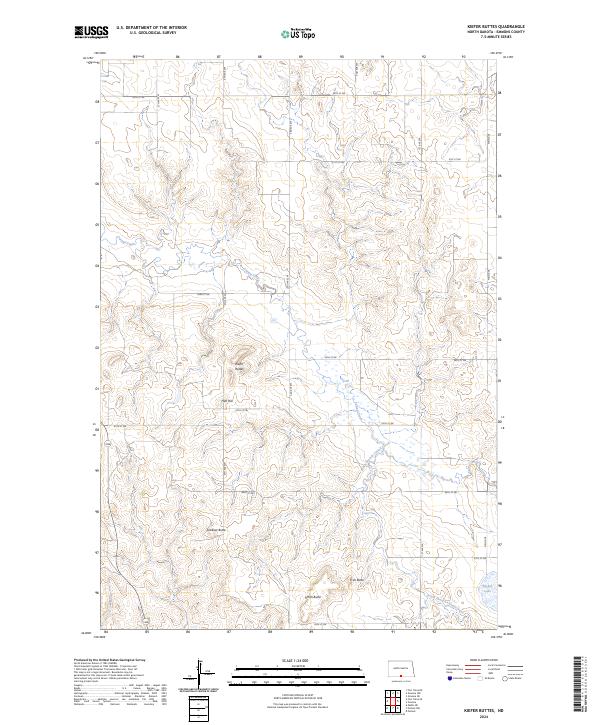
2024 Map of Kiefer Buttes
USGS Topo · Published 2024About this map
The rolling prairies of Emmons County are defined by a series of prominent topographic landmarks that rise above the drainage of Cattail Creek. This landscape is marked by several named elevations including Kiefer Buttes, Hall Hill, and Lookout Butte, which likely served as important navigational points for early residents and travelers. In the southeastern reaches, Smith Butte and Fritz Butte overlook the South Branch Cattail Creek, while Becker Lake provides a rare pocket of permanent water in this primarily upland terrain.
Find a feature on this map
28 named features on this map. Tap any name to fly to it.
Don’t see what you’re looking for? This feature index may not catch every label — zoom into the map to look around manually.
Map Details
Editions of this 2024 Kiefer Buttes Map
This is the sole edition of this map. No revisions or reprints were ever made.
Other maps of this area

1953 · McIntosh
USGS Topo · 1:250,000

1954 · Bismarck
USGS Topo · 1:250,000

1958 · Bismarck
USGS Topo · 1:250,000

1958 · McIntosh
USGS Topo · 1:250,000

1965 · Pollock
USGS Topo · 1:24,000

1966 · Mahto NE
USGS Topo · 1:24,000

1966 · Pollock NW
USGS Topo · 1:24,000

1968 · Fort Yates SE
USGS Topo · 1:24,000

1968 · Fort Yates NE
USGS Topo · 1:24,000

1971 · Grassna NW
USGS Topo · 1:24,000