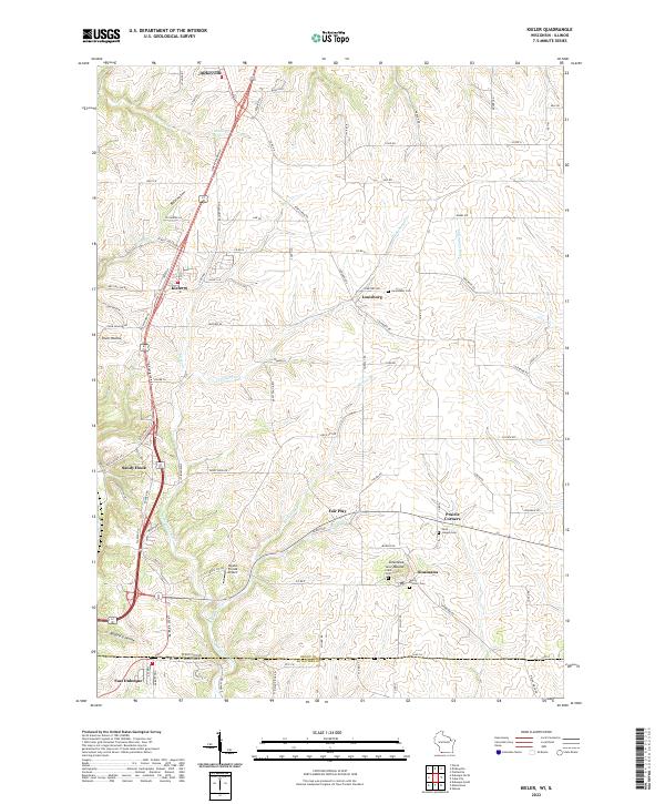
2022 Map of Kieler
USGS Topo · Published 2022About this map
The Menominee River valley and the rolling driftless landscape of Grant Co define this borderland where Wisconsin meets Illinois. The area is anchored by several long-standing Catholic landmarks, most notably the Sinsinawa Mound and its associated Saint Clara Cem, as well as Saint Joseph Cem near Prairie Corners. The map details a dense network of local roads such as Peddle Hollow Rd and Jimtown Rd that connect small farming settlements like Louisburg and Dickeyville. This 2022 survey captures the modern rural character of the region, including smaller aviation hubs like Rigdon Private Airport and the geological features of the coulee country, including Bethel Hollow and Boatyard Hollow along the river banks.
Find a feature on this map
85 named features on this map. Tap any name to fly to it.
Don’t see what you’re looking for? This feature index may not catch every label — zoom into the map to look around manually.
Map Details
Editions of this 2022 Kieler Map
This is the sole edition of this map. No revisions or reprints were ever made.
Historical Maps of Jamestown Through Time
6 maps found