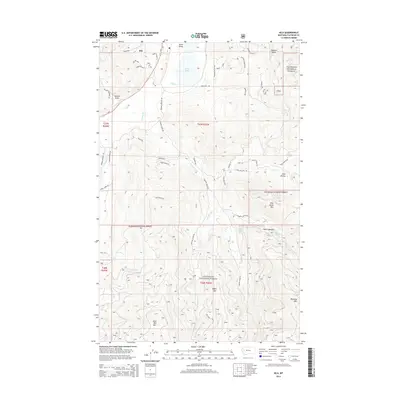
2014 Map of Kila
USGS Topo · Published 2014About this map
Kila serves as the primary settlement hub in this part of Flathead County, situated just west of Smith Valley and the waters of Smith Lake. The landscape is defined by the high ridges of the Flathead National Forest, which covers much of the southern and eastern portions of the map. This area is characterized by a complex network of forest roads and trails, such as Forest Ridge Trl and Broken Arrow Trl, that provide access to the timbered heights of Wild Bill Mtn and Eagle Mtn. Drainage patterns are dictated by numerous creeks, including Truman Cr and Ashley Cr, which wind through the valleys and draws. The transition from the more developed valley floor near Us-2 to the steep terrain of Smoke Rdg and Wild Horse Mtn highlights the region's reliance on both agriculture and forestry.
Find a feature on this map
61 named features on this map. Tap any name to fly to it.
Don’t see what you’re looking for? This feature index may not catch every label — zoom into the map to look around manually.
Map Details
Editions of this 2014 Kila Map
This is the sole edition of this map. No revisions or reprints were ever made.
Other maps of this area

1920 · Flathead Lake
USGS Topo · 1:125,000

1943 · Kalispell
USGS Topo · 1:125,000

1956 · Wallace
USGS Topo · 1:250,000

1957 · Kalispell
USGS Topo · 1:250,000

1960 · Kalispell
USGS Topo · 1:250,000

1960 · Wallace
USGS Topo · 1:250,000

1961 · Kalispell
USGS Topo · 1:250,000

1962 · Kila
USGS Topo · 1:24,000

1962 · Blue Grass Ridge
USGS Topo · 1:24,000

1962 · Lion Mountain
USGS Topo · 1:24,000