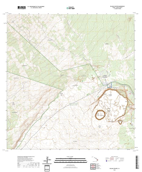
2024 Map of Kilauea Crater
USGS Topo · Published 2024About this map
Hawai‘i Volcanoes National Park dominates this landscape on the Island of Hawai‘i, centering on the active geological features of Kĩlauea. The settlement of Volcano sits at the northeastern edge, serving as a gateway to the volcanic plateau. Researchers can trace the progression of volcanic activity through a series of documented flows, including the Lava Flow of 1880, Lava Flow of 1919, and the more recent Lava Flow of 1974 near Halēma‘uma‘u.
Find a feature on this map
49 named features on this map. Tap any name to fly to it.
Don’t see what you’re looking for? This feature index may not catch every label — zoom into the map to look around manually.
Map Details
Editions of this 2024 Kilauea Crater Map
This is the sole edition of this map. No revisions or reprints were ever made.
Other maps of this area

1917 · Hilo
USGS Topo · 1:62,500

1921 · Kilauea
USGS Topo · 1:62,500

1922 · Puna
USGS Topo · 1:62,500

1924 · Kilauea
USGS Topo · 1:62,500

1924 · Puna
USGS Topo · 1:62,500

1930 · Humuula
USGS Topo · 1:62,500

1932 · Hilo
USGS Topo · 1:62,500

1954 · Hawaii South
USGS Topo · 1:250,000

1954 · Hawaii North
USGS Topo · 1:250,000
1956 · Puu Ulaula
USGS Topo · 1:24,000