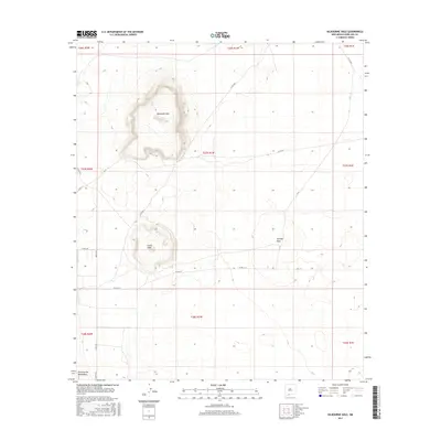
2017 Map of Kilbourne Hole
USGS Topo · Published 2017About this map
The remarkable volcanic craters of the Potrillo volcanic field define this landscape in Doña Ana County. Central to the map is Kilbourne Hole, a prominent maar crater known for its distinct depression and geological significance. To the south lies Hunts Hole, another well-defined volcanic feature, while Phillips Hole sits further to the east. These geological structures were formed by steam explosions when rising magma met groundwater, creating the deep basins visible today.
Find a feature on this map
24 named features on this map. Tap any name to fly to it.
Don’t see what you’re looking for? This feature index may not catch every label — zoom into the map to look around manually.
Map Details
Editions of this 2017 Kilbourne Hole Map
This is the sole edition of this map. No revisions or reprints were ever made.
Other maps of this area

1891 · Las Cruces
USGS Topo · 1:125,000

1893 · Las Cruces
USGS Topo · 1:125,000

1917 · Noria
USGS Topo · 1:62,500

1917 · Mt. Riley
USGS Topo · 1:62,500

1918 · Mt. Riley
USGS Topo · 1:62,500

1918 · Noria
USGS Topo · 1:62,500

1929 · Mt. Riley
USGS Topo · 1:62,500

1941 · Aden
USGS Topo · 1:62,500

1943 · Aden
USGS Topo · 1:62,500

1943 · Afton
USGS Topo · 1:62,500