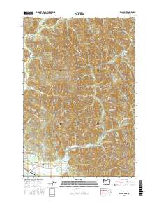
2017 Map of Kilchis River
USGS Topo · Published 2017About this map
The Kilchis River and Miami River systems dominate this coastal landscape, carving deep drainages into the high timberlands of Tillamook County. Near the southern edge, the community of Bay City sits just above the marshy lowlands, providing a clear view of the transition from industrial forest to the coastal interface. The presence of the Bay City IOOF Cem and the settlement of Idaville along Idaville Rd offers specific points of interest for genealogists tracing local families in the Tillamook Bay area. Moving inland, the map details an extensive network of logging and forest service roads, such as Kilchis River Forest Rd and Moss Creek Rd, which navigate around prominent landmarks like Tilden Bluffs and Doty Hill. Small tributaries including School Cr and Washout Cr illustrate the complex watershed that defines this region's geography and economic history.
Find a feature on this map
73 named features on this map. Tap any name to fly to it.
Don’t see what you’re looking for? This feature index may not catch every label — zoom into the map to look around manually.
Map Details
Editions of this 2017 Kilchis River Map
This is the sole edition of this map. No revisions or reprints were ever made.
Other maps of this area

1937 · Nehalem
USGS Topo · 1:62,500

1937 · Enright
USGS Topo · 1:62,500

1941 · Enright
USGS Topo · 1:62,500

1942 · Ginger Peak
USGS Topo · 1:62,500

1942 · Tillamook
USGS Topo · 1:62,500

1943 · Nehalem
USGS Topo · 1:62,500

1948 · Vancouver
USGS Topo · 1:250,000

1950 · Vancouver
USGS Topo · 1:250,000

1950 · Vancouver
USGS Topo · 1:250,000

1955 · Blaine
USGS Topo · 1:62,500