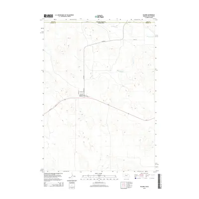
2014 Map of Kilgore
USGS Topo · Published 2014About this map
Kilgore sits at the heart of this Nebraska Sandhills region, positioned along the northern border where Cherry Co meets Todd Co in South Dakota. This 2014 survey captures the village's small-town street grid, including Columbus St, Washington St, and Jefferson St. The geography is defined by a complex pattern of interdunal depressions and ephemeral drainage basins, with Minnechaduza Creek flowing across the northern reaches near the state line. South of the main settlement, the Cowboy Trail runs parallel to Us-20, marking a legacy of the old Chicago and North Western railroad line converted for modern recreation. Water features like Spring Creek and Fox Reservoir Number 2 break the upland plains, providing critical points of reference in this sparsely populated cattle country.
Find a feature on this map
17 named features on this map. Tap any name to fly to it.
Don’t see what you’re looking for? This feature index may not catch every label — zoom into the map to look around manually.
Map Details
Editions of this 2014 Kilgore Map
This is the sole edition of this map. No revisions or reprints were ever made.
Other maps of this area

1950 · Kilgore
USGS Topo · 1:62,500

1950 · Cody
USGS Topo · 1:62,500

1955 · Martin
USGS Topo · 1:250,000

1957 · Valentine
USGS Topo · 1:250,000

1958 · Martin
USGS Topo · 1:250,000

1959 · Valentine
USGS Topo · 1:250,000

1969 · Spring Creek
USGS Topo · 1:24,000

1969 · St. Francis SW
USGS Topo · 1:24,000

1969 · St. Francis SE
USGS Topo · 1:24,000

1982 · Mission
USGS Topo · 1:100,000