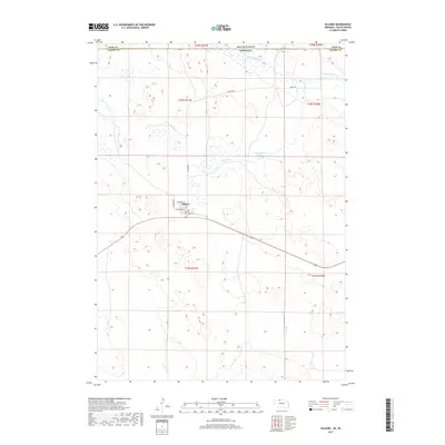
2017 Map of Kilgore
USGS Topo · Published 2017About this map
Kilgore serves as the central settlement in this portion of Cherry County, positioned just south of the border shared by South Dakota and Nebraska. The village layout is defined by streets such as Washington St and Columbus St, situated within a landscape characterized by the sandy hills of the Nebraska Sandhills region. This 2017 survey by the U.S. Geological Survey illustrates a traditional rural grid system crossing through sections t35n r31w and t34n r31w. Water resources are vital to this ranching country, with Minnechaduza Cr flowing through the northern reaches near the Todd County line and Spring Cr feeding into Fox Reservoir Number 2. The network of local thoroughfares like Kilgore Rd and Rocky Rd provides insight into the movement of people and livestock through this sparsely populated borderland.
Find a feature on this map
16 named features on this map. Tap any name to fly to it.
Don’t see what you’re looking for? This feature index may not catch every label — zoom into the map to look around manually.
Map Details
Editions of this 2017 Kilgore Map
This is the sole edition of this map. No revisions or reprints were ever made.
Other maps of this area

1950 · Kilgore
USGS Topo · 1:62,500

1950 · Cody
USGS Topo · 1:62,500

1955 · Martin
USGS Topo · 1:250,000

1957 · Valentine
USGS Topo · 1:250,000

1958 · Martin
USGS Topo · 1:250,000

1959 · Valentine
USGS Topo · 1:250,000

1969 · Spring Creek
USGS Topo · 1:24,000

1969 · St. Francis SW
USGS Topo · 1:24,000

1969 · St. Francis SE
USGS Topo · 1:24,000

1982 · Mission
USGS Topo · 1:100,000