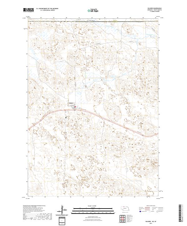
2021 Map of Kilgore
USGS Topo · Published 2021About this map
Kilgore sits near the Nebraska-South Dakota border, serving as a concentrated point of settlement within the expansive rangeland of Cherry Co. The town's grid, including Washington St and Hunt St, is bisected by the Cowboy Trl, a long-distance path following a former rail corridor through this section of the Sandhills. The landscape is dominated by a complex network of intermittent wetlands and drainages, most notably Minnechaduza Cr and Spring Cr, which feed into local catchments like Fox Reservoir Number 2. For those tracing local heritage, the Kilgore Cem is situated just southwest of the town center. The map also delineates the transition into South Dakota's Todd Co, illustrating the rural road network that includes family or local ranch landmarks such as Abc Ranch Dr and Two Mikes Rd.
Find a feature on this map
19 named features on this map. Tap any name to fly to it.
Don’t see what you’re looking for? This feature index may not catch every label — zoom into the map to look around manually.
Map Details
Editions of this 2021 Kilgore Map
This is the sole edition of this map. No revisions or reprints were ever made.
Other maps of this area

1950 · Kilgore
USGS Topo · 1:62,500

1950 · Cody
USGS Topo · 1:62,500

1955 · Martin
USGS Topo · 1:250,000

1957 · Valentine
USGS Topo · 1:250,000

1958 · Martin
USGS Topo · 1:250,000

1959 · Valentine
USGS Topo · 1:250,000

1969 · Spring Creek
USGS Topo · 1:24,000

1969 · St. Francis SW
USGS Topo · 1:24,000

1969 · St. Francis SE
USGS Topo · 1:24,000

1982 · Mission
USGS Topo · 1:100,000