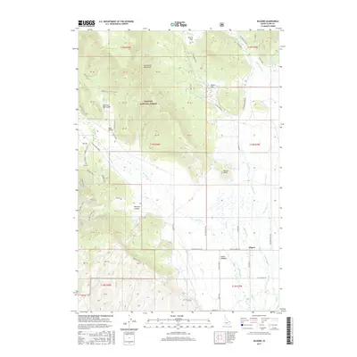
2017 Map of Kilgore
USGS Topo · Published 2017About this map
The high mountain valley of Kilgore sits at the base of the Centennial Mountains in this 2017 study of Clark County. The landscape is defined by the transition from the forested slopes of the Targhee National Forest to the broad, water-rich expanses of Camas Meadows. A complex network of drainage and irrigation is evident, with Camas Creek and W Camas Cr winding through the flats toward the south. To the north and west, the terrain rises into prominent features like Button Butte and McGarry Canyon, where the mountain foothills are marked by several forest service spurs and historic mining tracks including the Prospect Main and Goldmine Spur 2. This map provides a detailed look at the rural road network, from the straight lines of Kilgore Ln and Antelope Valley Rd to the winding timber access of the Cottonwood Loop.
Find a feature on this map
75 named features on this map. Tap any name to fly to it.
Don’t see what you’re looking for? This feature index may not catch every label — zoom into the map to look around manually.
Map Details
Editions of this 2017 Kilgore Map
This is the sole edition of this map. No revisions or reprints were ever made.
Other maps of this area

1950 · Lower Red Rock Lake
USGS Topo · 1:62,500

1955 · Dubois
USGS Topo · 1:250,000

1955 · Ashton
USGS Topo · 1:250,000

1958 · Dubois
USGS Topo · 1:250,000

1958 · Ashton
USGS Topo · 1:250,000

1960 · Ashton
USGS Topo · 1:250,000

1968 · Big Table Mountain
USGS Topo · 1:24,000

1972 · Pine Butte
USGS Topo · 1:24,000

1972 · Antelope Valley
USGS Topo · 1:24,000

1972 · Kilgore
USGS Topo · 1:24,000