
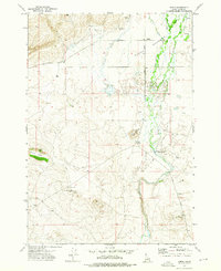
1972 Map of Antelope Valley
USGS Topo · Published 1976About this map
The U S Sheep Experiment Station occupies a significant portion of this high-altitude landscape along the border of Clark Co and Fremont Co. Established in the early 20th century to support the Western sheep industry, the station's presence indicates the specialized agricultural and research use of these mountain lands. The terrain is defined by the prominent Antelope Ridge and the broad Antelope Valley, with the northern section rising into the protected lands of the Targhee National Forest. A network of water sources, including Little Cottonwood Creek, Ching Creek, and numerous isolated Springs, suggests a landscape shaped by seasonal grazing and livestock management. A traditional Pack Trail winds through the forest near West Dry Creek, marking historical transit routes used before modern road development reached this portion of the Idaho backcountry.
Find a feature on this map
16 named features on this map. Tap any name to fly to it.
Don’t see what you’re looking for? This feature index may not catch every label — zoom into the map to look around manually.
Map Details
Editions of this 1972 Antelope Valley Map
This is the sole edition of this map. No revisions or reprints were ever made.
Other maps of this area

1950 · Lower Red Rock Lake
USGS Topo · 1:62,500

1950 · Upper Red Rock Lake
USGS Topo · 1:62,500

1955 · Ashton
USGS Topo · 1:250,000

1958 · Ashton
USGS Topo · 1:250,000

1960 · Ashton
USGS Topo · 1:250,000

1965 · Crystal Butte
USGS Topo · 1:24,000

1965 · Sheridan Reservoir
USGS Topo · 1:24,000

1972 · Pine Butte
USGS Topo · 1:24,000

1972 · Kilgore
USGS Topo · 1:24,000
1972 · Idmon
USGS Topo · 1:24,000