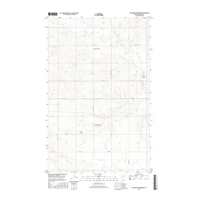
2017 Map of Killenbeck Reservoir
USGS Topo · Published 2017About this map
Four Buttes sits at the eastern edge of this Daniels County landscape, where the high plains are carved by a network of drainage creeks and coulees. The terrain is defined by the headwaters of Butte Cr, Brush Cr, and Spring Cr, which weave through the agricultural sections of the Public Land Survey System. The presence of Killenbeck Reservoir in the northwest corner highlights the importance of water management in this northern Montana environment.
Find a feature on this map
17 named features on this map. Tap any name to fly to it.
Don’t see what you’re looking for? This feature index may not catch every label — zoom into the map to look around manually.
Map Details
Editions of this 2017 Killenbeck Reservoir Map
This is the sole edition of this map. No revisions or reprints were ever made.
Other maps of this area

1954 · Wolf Point
USGS Topo · 1:250,000

1958 · Wolf Point
USGS Topo · 1:250,000

1973 · Peerless 4 NE
USGS Topo · 1:24,000

1973 · West Fork NE
USGS Topo · 1:24,000

1973 · Peerless
USGS Topo · 1:24,000

1973 · Carbert
USGS Topo · 1:24,000

1973 · Killenbeck Reservoir
USGS Topo · 1:24,000

1973 · Four Buttes NE
USGS Topo · 1:24,000

1973 · Four Buttes
USGS Topo · 1:24,000

1973 · Four Buttes NW
USGS Topo · 1:24,000