
1973 Map of Peerless 4 NE
USGS Topo · Published 1976About this map
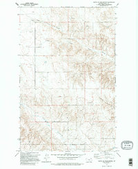
The Fort Peck Indian Reservation Boundary cuts across the southern portion of this landscape in northeast Montana, marking a significant administrative and cultural dividing line in Daniels County. The terrain is defined by an intricate network of drainage systems, most notably Negro Coulee and Cabarett Coulee, which carve through the high plains. Water sources are scarce, indicated by scattered Spring sites and occasional Well markings that supported local ranching operations. The presence of several Storage Bin labels and a Gravel Pit along the northern reaches suggests a landscape dedicated to grain production and the maintenance of rural infrastructure. Police Creek flows through the southwestern corner, further illustrating the vital role of these intermittent watercourses in an area where topography and survival are closely linked to the coulee system.
Find a feature on this map
9 named features on this map. Tap any name to fly to it.
Don’t see what you’re looking for? This feature index may not catch every label — zoom into the map to look around manually.
Map Details
Editions of this 1973 Peerless 4 NE Map
2 editions found
Other maps of this area

1954 · Wolf Point
USGS Topo · 1:250,000

1958 · Wolf Point
USGS Topo · 1:250,000

1973 · Scobey
USGS Topo · 1:24,000

1973 · Nielsen Coulee
USGS Topo · 1:24,000

1973 · Killenbeck Reservoir
USGS Topo · 1:24,000

1973 · Cabarett Coulee
USGS Topo · 1:24,000

1973 · Peerless 4 SE
USGS Topo · 1:24,000

1973 · Peerless 4 SW
USGS Topo · 1:24,000

1973 · Four Buttes
USGS Topo · 1:24,000
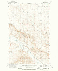
1973 · Peerless 4 NW
USGS Topo · 1:24,000