
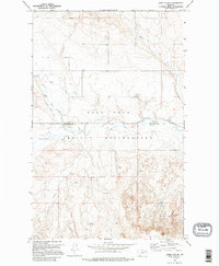
1973 Map of Peerless 4 SE
USGS Topo · Published 1976About this map
The Fort Peck Indian Reservation encompasses this section of northeastern Montana, where the high plains are dissected by a network of seasonal and permanent watercourses. The most prominent hydrological feature is the West Fork Poplar River, which flows across the landscape near the border of Daniels and Roosevelt Counties. Smaller tributaries like Police Creek and Cottonwood Creek cut through the terrain, creating the distinct Coulee formations characteristic of the region.
Find a feature on this map
11 named features on this map. Tap any name to fly to it.
Don’t see what you’re looking for? This feature index may not catch every label — zoom into the map to look around manually.
Map Details
Editions of this 1973 Peerless 4 SE Map
2 editions found
Other maps of this area

1910 · Cuskers
USGS Topo · 1:62,500

1915 · Tule Valley
USGS Topo · 1:62,500

1915 · Cuskers
USGS Topo · 1:62,500

1954 · Wolf Point
USGS Topo · 1:250,000

1958 · Wolf Point
USGS Topo · 1:250,000

1973 · Peerless 4 NE
USGS Topo · 1:24,000

1973 · Nielsen Coulee
USGS Topo · 1:24,000

1973 · Cabarett Coulee
USGS Topo · 1:24,000

1973 · Peerless 4 SW
USGS Topo · 1:24,000
1973 · Peerless 4 NW
USGS Topo · 1:24,000