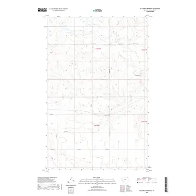
2020 Map of Killenbeck Reservoir
USGS Topo · Published 2020About this map
Killenbeck Reservoir anchors the northern portion of this High Plains landscape in Daniels County. The terrain is defined by the subtle drainage of Butte Cr, reflecting the characteristic topography of the Missouri Plateau. This 2020 edition reveals the expansive rural layout of the region, where a grid of section-line roads like Butte Valley Road and Chicoine Road connects isolated ranching interests and seasonal wetlands. The map illustrates how human settlement adapts to the drainage patterns of the northern plains, with road networks carefully tracing the dry coulees and creek beds that define the local hydrology. This representation is essential for understanding modern land use and water management in one of Montana's most northern reaches near the Canadian border.
Find a feature on this map
2 named features on this map. Tap any name to fly to it.
Don’t see what you’re looking for? This feature index may not catch every label — zoom into the map to look around manually.
Map Details
Editions of this 2020 Killenbeck Reservoir Map
This is the sole edition of this map. No revisions or reprints were ever made.
Other maps of this area

1954 · Wolf Point
USGS Topo · 1:250,000

1958 · Wolf Point
USGS Topo · 1:250,000

1973 · Peerless 4 NE
USGS Topo · 1:24,000

1973 · West Fork NE
USGS Topo · 1:24,000

1973 · Peerless
USGS Topo · 1:24,000

1973 · Carbert
USGS Topo · 1:24,000

1973 · Killenbeck Reservoir
USGS Topo · 1:24,000

1973 · Four Buttes NE
USGS Topo · 1:24,000

1973 · Four Buttes
USGS Topo · 1:24,000

1973 · Four Buttes NW
USGS Topo · 1:24,000