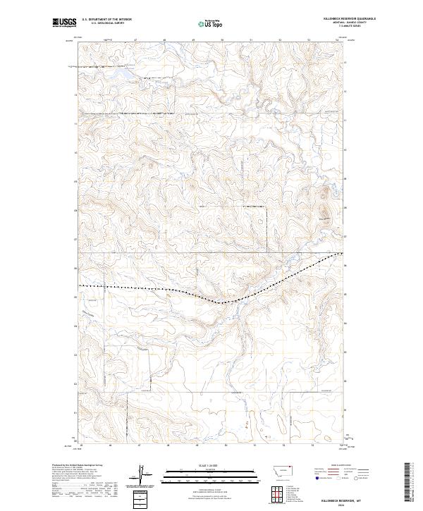
2024 Map of Killenbeck Reservoir
USGS Topo · Published 2024About this map
Killenbeck Reservoir and the headwaters of Brush Creek define the high plains drainage of this corner of Daniels County. The landscape is marked by the distinct topographic relief of Olson Coulee and the settlement at Four Buttes in the eastern portion of the quadrangle. This 2024 survey captures a rural Montana network of section-line roads and family-named routes, including Gilchrist Rd, Anderson Rd, and Chicoine Rd, which provide access to the expansive agricultural and grazing lands. The drainage pattern is further detailed by the courses of Spring Creek and Butte Creek, illustrating how water management and natural hydrology shape the land use within the township and range boundaries of t36n r46e and t36n r47e.
Find a feature on this map
19 named features on this map. Tap any name to fly to it.
Don’t see what you’re looking for? This feature index may not catch every label — zoom into the map to look around manually.
Map Details
Editions of this 2024 Killenbeck Reservoir Map
This is the sole edition of this map. No revisions or reprints were ever made.
Other maps of this area

1954 · Wolf Point
USGS Topo · 1:250,000

1958 · Wolf Point
USGS Topo · 1:250,000

1973 · Peerless 4 NE
USGS Topo · 1:24,000

1973 · West Fork NE
USGS Topo · 1:24,000

1973 · Peerless
USGS Topo · 1:24,000

1973 · Carbert
USGS Topo · 1:24,000

1973 · Killenbeck Reservoir
USGS Topo · 1:24,000

1973 · Four Buttes NE
USGS Topo · 1:24,000

1973 · Four Buttes
USGS Topo · 1:24,000

1973 · Four Buttes NW
USGS Topo · 1:24,000