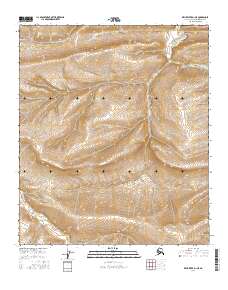
2016 Map of Killik River D-1 NE
USGS Topo · Published 2016About this map
Niakogon Mtn dominates the southeastern quadrant of this Arctic landscape, representing the most significant relief in this portion of the North Slope Borough. The terrain is defined by its drainage systems, most notably the headwaters of the S Fork Ninuluk Cr in the northeast and Coal Cr in the southwest. This 2016 survey illustrates the remote character of the Brooks Range foothills, where land is primarily organized by the Public Land Survey System grids of t5s r6w, t5s r5w, t6s r6w, and t6s r5w. The intricate contour intervals highlight the complex ridges and valleys that define the watershed before these streams eventually contribute to the larger Arctic drainage basin.
Find a feature on this map
7 named features on this map. Tap any name to fly to it.
Don’t see what you’re looking for? This feature index may not catch every label — zoom into the map to look around manually.
Map Details
Editions of this 2016 Killik River D-1 NE Map
This is the sole edition of this map. No revisions or reprints were ever made.
Other maps of this area

1951 · Ikpikpuk River
USGS Topo · 1:250,000

1951 · Chandler Lake
USGS Topo · 1:250,000

1951 · Killik River
USGS Topo · 1:250,000

1952 · Umiat
USGS Topo · 1:250,000

1955 · Umiat A-5
USGS Topo · 1:63,360

1956 · Chandler Lake
USGS Topo · 1:250,000

1956 · Killik River
USGS Topo · 1:250,000

1956 · Ikpikpuk River
USGS Topo · 1:250,000

1956 · Umiat
USGS Topo · 1:250,000

1964 · Chandler Lake
USGS Topo · 1:250,000