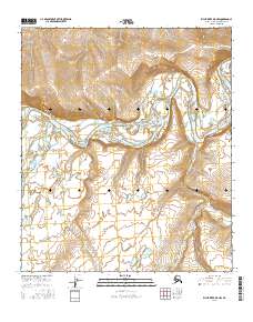
2016 Map of Killik River D-5 NW
USGS Topo · Published 2016About this map
The confluence of the Etivluk River and the Colville River dominates this Arctic landscape on the North Slope. These watercourses serve as primary natural corridors through the varied terrain of the t5s r17w and t5s r16w townships. The map illustrates a complex fluvial system where the rivers meander through wide valleys, leaving behind intricate drainage patterns and small tributaries like Kucher Cr. This 2016 survey documents the shifting channels and topography of a remote region where the river systems are the defining features of the geography, reflecting the seasonal flow and landform evolution of the northern Alaskan interior.
Find a feature on this map
7 named features on this map. Tap any name to fly to it.
Don’t see what you’re looking for? This feature index may not catch every label — zoom into the map to look around manually.
Map Details
Editions of this 2016 Killik River D-5 NW Map
This is the sole edition of this map. No revisions or reprints were ever made.
Other maps of this area

1951 · Lookout Ridge
USGS Topo · 1:250,000

1951 · Ikpikpuk River
USGS Topo · 1:250,000

1951 · Howard Pass
USGS Topo · 1:250,000

1951 · Killik River
USGS Topo · 1:250,000

1956 · Lookout Ridge
USGS Topo · 1:250,000

1956 · Howard Pass
USGS Topo · 1:250,000

1956 · Killik River
USGS Topo · 1:250,000

1956 · Ikpikpuk River
USGS Topo · 1:250,000

1984 · Howard Pass D-1
USGS Topo · 1:63,360

1984 · Killik River D-5
USGS Topo · 1:63,360