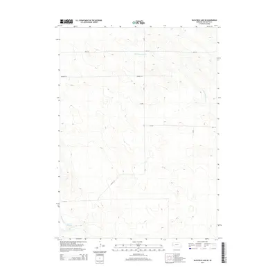
2014 Map of Kilpatrick Lake NE
USGS Topo · Published 2014About this map
Cook NW Reservoir sits in the southwestern portion of this Nebraska landscape, where the N Br Snake Cr and Snake Cr converge to define the local hydrology. This 2014 survey documents a section of Box Butte County characterized by a structured grid of rural transport, including arterial routes like Hayes Rd and Jefferson Rd. The terrain is shaped by several drainage branches, most notably the S Br Point of Rocks Cr winding through the northern sections. This survey provides a clear look at the contemporary land divisions and water management features essential to the region's agricultural infrastructure, marking a period of modern topographical consistency in the Great Plains. The intersection of roads such as Keith Rd and CR-82 illustrates the continued importance of these section-line paths for local connectivity.
Find a feature on this map
12 named features on this map. Tap any name to fly to it.
Don’t see what you’re looking for? This feature index may not catch every label — zoom into the map to look around manually.
Map Details
Editions of this 2014 Kilpatrick Lake NE Map
This is the sole edition of this map. No revisions or reprints were ever made.
Other maps of this area

1946 · Nonpareil
USGS Topo · 1:24,000

1948 · Hemingford 4 SW
USGS Topo · 1:24,000

1948 · Hemingford 4 NW
USGS Topo · 1:24,000

1948 · Nonpareil
USGS Topo · 1:24,000

1951 · Marsland
USGS Topo · 1:62,500

1951 · Kilpatrick Lake
USGS Topo · 1:62,500

1955 · Alliance
USGS Topo · 1:250,000

1957 · Alliance
USGS Topo · 1:250,000

1958 · Alliance
USGS Topo · 1:250,000
1983 · Marsland SE
USGS Topo · 1:24,000