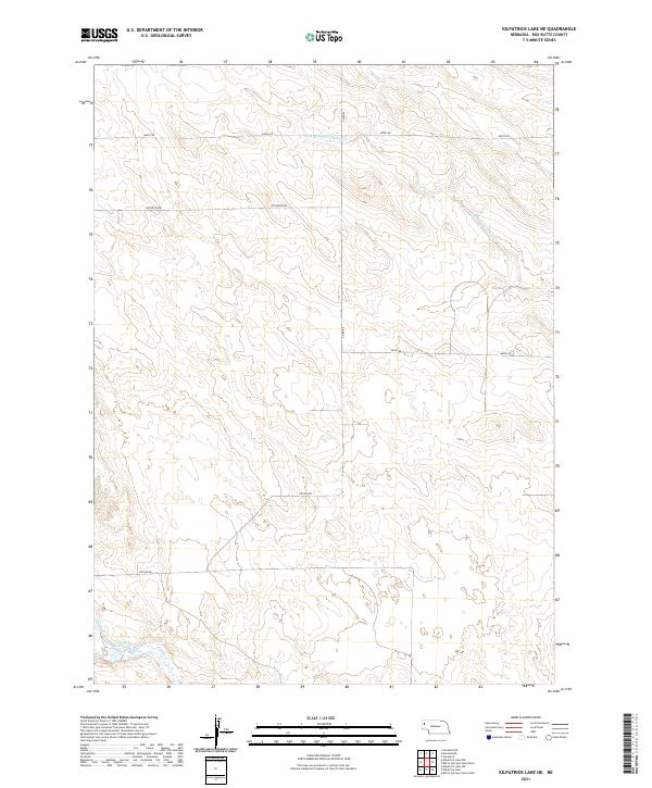
2021 Map of Kilpatrick Lake NE
USGS Topo · Published 2021About this map
S Br Point of Rocks Cr and the drainages of the Snake Cr system define this section of Box Butte County, Nebraska. The landscape is organized by the Public Land Survey System, with township boundaries for t26n r52w, t26n r51w, t25n r52w, and t25n r51w creating a rigid grid across the open terrain. This 2021 survey reveals a sparse settlement pattern dominated by large-scale agricultural divisions and a network of section-line roads, including Hayes Rd and Lincoln Rd. A primary water feature in the southwest corner, the Cook NW Reservoir, sits near the confluence where N Br Snake Cr meets the main creek bed. The map serves as a clear record of modern High Plains land management, showing how water resources and road networks like Keith Rd continue to follow historical survey lines established decades prior.
Find a feature on this map
12 named features on this map. Tap any name to fly to it.
Don’t see what you’re looking for? This feature index may not catch every label — zoom into the map to look around manually.
Map Details
Editions of this 2021 Kilpatrick Lake NE Map
This is the sole edition of this map. No revisions or reprints were ever made.
Other maps of this area

1946 · Nonpareil
USGS Topo · 1:24,000

1948 · Hemingford 4 SW
USGS Topo · 1:24,000

1948 · Hemingford 4 NW
USGS Topo · 1:24,000

1948 · Nonpareil
USGS Topo · 1:24,000

1951 · Marsland
USGS Topo · 1:62,500

1951 · Kilpatrick Lake
USGS Topo · 1:62,500

1955 · Alliance
USGS Topo · 1:250,000

1957 · Alliance
USGS Topo · 1:250,000

1958 · Alliance
USGS Topo · 1:250,000
1983 · Marsland SE
USGS Topo · 1:24,000