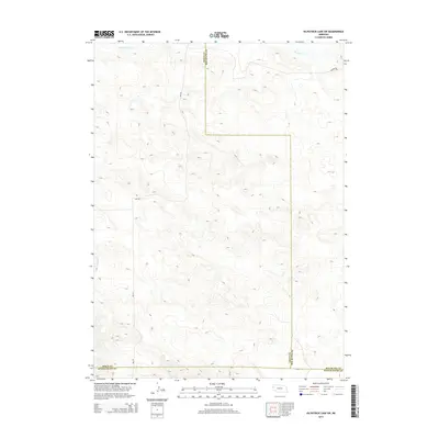
2014 Map of Kilpatrick Lake SW
USGS Topo · Published 2014About this map
High plains topography characterizes this section of the Nebraska panhandle, where the boundaries of Sioux, Box Butte, and Scotts Bluff counties converge. The landscape is defined by its intermittent drainage systems, including the headwaters of Mud Springs Creek in the northwest and South Branch Snake Creek to the northeast. These ephemeral watercourses suggest a terrain shaped by seasonal moisture, typical of the region's ranching and agricultural heritage. Transportation across these open stretches is facilitated by a grid of rural routes such as Ore Road and Perkins Road, which provide access through the undulating hills. Further south, Winters Creek marks the drainage toward the North Platte valley, while local connectors like Cr-A and Cr-34 link the scattered ranch lands across the county lines.
Find a feature on this map
10 named features on this map. Tap any name to fly to it.
Don’t see what you’re looking for? This feature index may not catch every label — zoom into the map to look around manually.
Map Details
Editions of this 2014 Kilpatrick Lake SW Map
This is the sole edition of this map. No revisions or reprints were ever made.
Other maps of this area

1898 · Scotts Bluff
USGS Topo · 1:125,000

1898 · Camp Clarke
USGS Topo · 1:125,000

1899 · Whistle Creek
USGS Topo · 1:125,000

1951 · Kilpatrick Lake
USGS Topo · 1:62,500

1954 · Scottsbluff
USGS Topo · 1:250,000

1955 · Alliance
USGS Topo · 1:250,000

1957 · Alliance
USGS Topo · 1:250,000

1958 · Alliance
USGS Topo · 1:250,000

1958 · Scottsbluff
USGS Topo · 1:250,000
1965 · Bayard NE
USGS Topo · 1:24,000