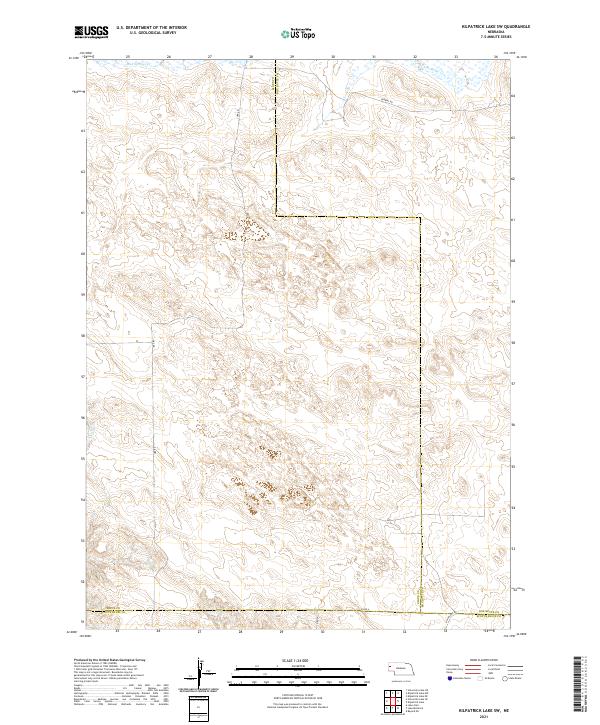
2021 Map of Kilpatrick Lake SW
USGS Topo · Published 2021About this map
High plains ranching and drainage patterns define this corner of Western Nebraska, where the borders of Sioux, Box Butte, and Scotts Bluff counties converge. The landscape is marked by subtle watercourses that have historically dictated the placement of travel routes and grazing lands. In the northern reaches, Mud Springs Cr and S Br Snake Cr flow through the undulating terrain, while Winters Cr begins its path in the southwest. A sparse grid of rural thoroughfares, including Ore Rd, Perkins Rd, and Co Rd A, connects isolated homesteads and ranching operations across the section lines. This document preserves the late-period land divisions and topographical character of the Nebraska panhandle prior to modern developments.
Find a feature on this map
17 named features on this map. Tap any name to fly to it.
Don’t see what you’re looking for? This feature index may not catch every label — zoom into the map to look around manually.
Map Details
Editions of this 2021 Kilpatrick Lake SW Map
This is the sole edition of this map. No revisions or reprints were ever made.
Other maps of this area

1898 · Scotts Bluff
USGS Topo · 1:125,000

1898 · Camp Clarke
USGS Topo · 1:125,000

1899 · Whistle Creek
USGS Topo · 1:125,000

1951 · Kilpatrick Lake
USGS Topo · 1:62,500

1954 · Scottsbluff
USGS Topo · 1:250,000

1955 · Alliance
USGS Topo · 1:250,000

1957 · Alliance
USGS Topo · 1:250,000

1958 · Alliance
USGS Topo · 1:250,000

1958 · Scottsbluff
USGS Topo · 1:250,000
1965 · Bayard NE
USGS Topo · 1:24,000