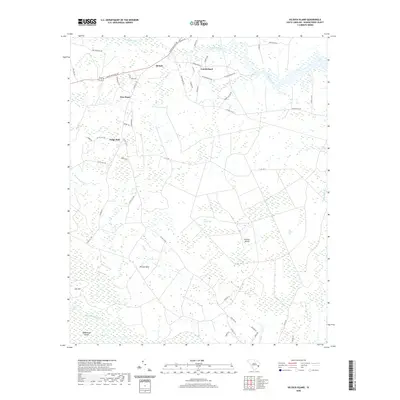
2020 Map of Kilsock Island
USGS Topo · Published 2020About this map
The Sampit River and its intricate network of coastal wetlands dominate this Georgetown County landscape, illustrating the watery geography of the Lowcountry. Small, dispersed settlements such as Lodge Hall, New Hope, and Sampit are connected by a web of local roads, including Saints Delight Rd and Pennyroyal Rd. The terrain is characterized by large depressional wetlands known as Carolina bays, specifically Little Kilsock Bay and Big Kilsock Bay, which appear as distinct oval features in the sandy soil. To the south, Kilsock Island and Wadmacon Island are defined by the meandering courses of Wadmacon Creek and Boggy Swamp. This geography reveals a long-standing pattern of navigation and settlement concentrated on the slightly higher ground between the river and its extensive marshy tributaries, where communities like Cumberland and Britton Neck established themselves near the headwaters and creek branches.
Find a feature on this map
54 named features on this map. Tap any name to fly to it.
Don’t see what you’re looking for? This feature index may not catch every label — zoom into the map to look around manually.
Map Details
Editions of this 2020 Kilsock Island Map
This is the sole edition of this map. No revisions or reprints were ever made.
Other maps of this area

1942 · Cedar Creek
USGS Topo · 1:24,000

1942 · Honey Hill
USGS Topo · 1:24,000

1943 · Olin
USGS Topo · 1:31,680

1943 · Kilsock Bay
USGS Topo · 1:24,000

1943 · Andrews
USGS Topo · 1:24,000

1943 · Santee
USGS Topo · 1:24,000

1943 · Georgetown North
USGS Topo · 1:24,000

1943 · Minim Island
USGS Topo · 1:24,000

1943 · Georgetown South
USGS Topo · 1:24,000

1947 · Georgetown South
USGS Topo · 1:24,000