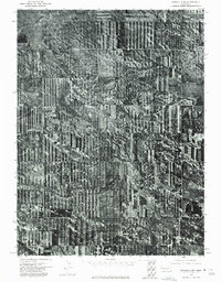
1973 Map of Kimball 2 NW
USGS Topo · Published 1975About this map
The High Plains of the Nebraska Panhandle are captured here in an orthophotomosaic composed of aerial imagery taken in May 1973. This particular landscape is defined by its agricultural geometry, showing a sophisticated system of strip-cropping and field management common to the western edges of the state. Long Canyon cuts through the northwest corner of the map, providing a distinct break in the otherwise ordered agricultural pattern. Because this is an orthophotoquad, the map emphasizes the actual land use and vegetation density of the era rather than traditional topographic symbols, offering a raw view of the drainage patterns and soil conservation practices employed by local farmers in the early 1970s.
Find a feature on this map
1 named feature on this map. Tap any name to fly to it.
Don’t see what you’re looking for? This feature index may not catch every label — zoom into the map to look around manually.
Map Details
Editions of this 1973 Kimball 2 NW Map
This is the sole edition of this map. No revisions or reprints were ever made.
Other maps of this area

1898 · Scotts Bluff
USGS Topo · 1:125,000

1899 · Goshen Hole
USGS Topo · 1:125,000

1954 · Scottsbluff
USGS Topo · 1:250,000

1954 · Cheyenne
USGS Topo · 1:250,000

1958 · Cheyenne
USGS Topo · 1:250,000

1958 · Scottsbluff
USGS Topo · 1:250,000

1960 · Tremain
USGS Topo · 1:24,000

1963 · Lindbergh
USGS Topo · 1:24,000

1973 · Kimball 2 NE
USGS Topo · 1:24,000

1973 · Kimball 2 SE
USGS Topo · 1:24,000