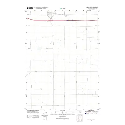
2012 Map of Kimball South
USGS Topo · Published 2012About this map
The southern edge of Kimball, South Dakota, anchors this rural landscape, showing the transition from a small-town residential grid to the expansive section-line road network of the High Plains. North of the interstate, the town’s street structure is clearly defined by routes like Railway St, W Broad St, and S Main St, which give way to the cemetery grounds of Saint Margarets Cem. This 2012 survey illustrates the enduring agricultural geometry of Brule County, where long, straight thoroughfares such as 364th Ave and 251st St parcel out the landscape. The map provides a high-resolution look at the drainage patterns and small depressions characteristic of the region, detailing how these natural features intersect with the human-imposed grid of gravel and paved roads that connect remote farmsteads to the regional commerce center.
Find a feature on this map
24 named features on this map. Tap any name to fly to it.
Don’t see what you’re looking for? This feature index may not catch every label — zoom into the map to look around manually.
Map Details
Editions of this 2012 Kimball South Map
This is the sole edition of this map. No revisions or reprints were ever made.
Other maps of this area

1941 · Pukwana
USGS Topo · 1:62,500

1941 · Kimball North
USGS Topo · 1:62,500

1951 · Pukwana
USGS Topo · 1:62,500

1951 · Kimball North
USGS Topo · 1:62,500

1955 · Mitchell
USGS Topo · 1:250,000

1959 · Mitchell
USGS Topo · 1:250,000

1979 · Bijou Hills NE
USGS Topo · 1:24,000

1979 · Cedar Grove Colony
USGS Topo · 1:24,000

1979 · Eagle
USGS Topo · 1:24,000

1979 · Platte Lake
USGS Topo · 1:24,000