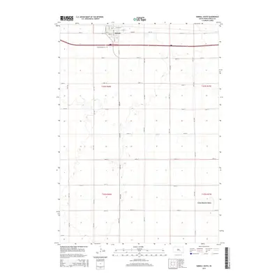
2015 Map of Kimball South
USGS Topo · Published 2015About this map
The town of Kimball serves as the focal point of this Brule County survey, positioned at the intersection of a significant east-west transportation corridor and local thoroughfares like S Main St and W Broad St. Just south of the municipal center lies Saint Margarets Cem, a key landmark for genealogical research in Kimball Township. The landscape transitions from the urban grid of the town to a structured section-line road system, including named routes such as 362nd Ave and 255th St, which define the agricultural character of the region. To the southeast, the presence of the Grass Ranch Colony provides an insight into the communal agricultural settlements that characterize this portion of South Dakota. The topography is marked by numerous small depressions and basins, typical of the glaciated plains, interspersed between the townships of t103n r68w and t102n r67w.
Find a feature on this map
32 named features on this map. Tap any name to fly to it.
Don’t see what you’re looking for? This feature index may not catch every label — zoom into the map to look around manually.
Map Details
Editions of this 2015 Kimball South Map
This is the sole edition of this map. No revisions or reprints were ever made.
Other maps of this area

1941 · Pukwana
USGS Topo · 1:62,500

1941 · Kimball North
USGS Topo · 1:62,500

1951 · Pukwana
USGS Topo · 1:62,500

1951 · Kimball North
USGS Topo · 1:62,500

1955 · Mitchell
USGS Topo · 1:250,000

1959 · Mitchell
USGS Topo · 1:250,000

1979 · Bijou Hills NE
USGS Topo · 1:24,000

1979 · Cedar Grove Colony
USGS Topo · 1:24,000

1979 · Eagle
USGS Topo · 1:24,000

1979 · Platte Lake
USGS Topo · 1:24,000