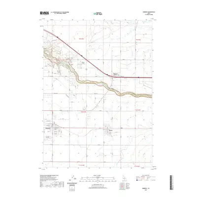
2020 Map of Kimberly
USGS Topo · Published 2020About this map
The Snake River carves a deep path between Jerome and Twin Falls counties, defining the northern edge of this 2020 landscape. This area serves as a primary hub for Magic Valley agriculture, where a sophisticated network of irrigation channels like the Twin Falls Main Canal and various laterals, including Lateral C-48 and Lateral C-55, support the surrounding farmland. The settlements of Kimberly and Hansen are positioned along the southern corridor, while the high-altitude Fairbanks Airfield and the intersection at Tipperary Corner mark the transition toward the river's canyon. Geologic landmarks such as Box Canyon, Vineyard Lake, and the heights of China Ridge provide a clear view of the Snake River's basalt-walled gorge. Significant infrastructure like the Hansen Bridge and the Twin Falls Grade facilitate travel across this steep terrain, connecting the rural residential pockets and industrial agriculture that characterize the region today.
Find a feature on this map
63 named features on this map. Tap any name to fly to it.
Don’t see what you’re looking for? This feature index may not catch every label — zoom into the map to look around manually.
Map Details
Editions of this 2020 Kimberly Map
This is the sole edition of this map. No revisions or reprints were ever made.
Other maps of this area

1955 · Twin Falls
USGS Topo · 1:250,000

1958 · Twin Falls
USGS Topo · 1:250,000

1964 · Kimberly
USGS Topo · 1:24,000

1964 · Falls City
USGS Topo · 1:24,000

1964 · Twin Falls
USGS Topo · 1:24,000

1964 · Eden
USGS Topo · 1:24,000

1964 · Perrine
USGS Topo · 1:24,000

1964 · Hunt
USGS Topo · 1:24,000

1965 · Stricker Butte
USGS Topo · 1:24,000

1965 · Hub Butte
USGS Topo · 1:24,000